|
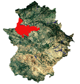
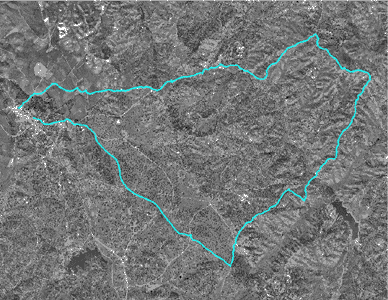
The route goes to the east of the urban core and the main attraction and axis of the tour to the Creek of the Rivera (that comes from Brozas and Villa del Rey) it crosses Mata south to north looking for the river mouth in Alcántara´s Reservoir. The tour circulates along flat and soft areas of the Boyal Pasture of the Montosa. It becomes more sloping and stony in the decrease and the raise to the riverbed of the Rivera, where bushes and the scrubland mainly dominate. It can be found the creek dry in the summer, with the exception of small pools where an interesting fauna lives.
In the first term the route passes through the boyal pasture of the village. There we can find a typical aged grove of evergreen oaks, and frequented cattle tracks over a practically flat area; Then, the route goes to the colada of the Montosa, where the landscape becomes dense with different levels and hilly, up to reach the road from Garrovillas to Alcántara. The route will continue from the crossing of the Rivera (where the Pantrigo´s mill is) and will take a way with worse conditions, with curves and ruts opened by the run-off of the rain, among leguminous bushes. Finally, we will see on the left side the valley that forms the creek, and on the right side the Alcántara´s flat areas with several houses.
The descent to the creek is not too tortuous, but the raise from Naharro´s Pontoon up to Mata is worse due to the conditions of the route: there are rocks and stones.
|