|
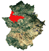
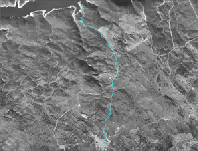
The tracing of this route takes us to the riberos of the Tagus by the old way of the Barca, now well known as the way of the Virgin of the River. This is a special place for the people from Talavan; in fact, there is a boat represented in its municipal shield.
Not a lot of time ago, in the decade of the 60´s of the last century, this route was very busy, as it was the link of communication of this zone with the north of the region. Julián, from Talavan remembers that he was allowed "to cross the boat", so he pulled the rope so strongly that moved the boat from one to another shore.
In the opposite border of the Tagus, there was the hermitage of its saint, the Virgin of the River, but after the retentions of the waters it remained covered. For that reason other one was constructed in the left border of the river, and this one could not be waded despite the big volume of water of the Alcántara´s Reservoir. The way, between among pastures few populated with oaks and an infinite white mantle of flowers of rockrose, now it is only frequented by few ranchers, except the day in which the pilgrimage of the saint is celebrated in the hermitage. Nowadays, from the three cattle routes classified under Talaván, only this way is equipped where the Path of the Royal Way of Castille passes through, though it is interrupted by the waters of the Tagus. This term has a good road surface with progressive decrease up to the riberos. We we will be able to go over it on foot, on a horse or by bicycle.
|