|
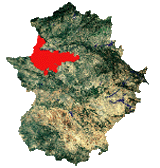
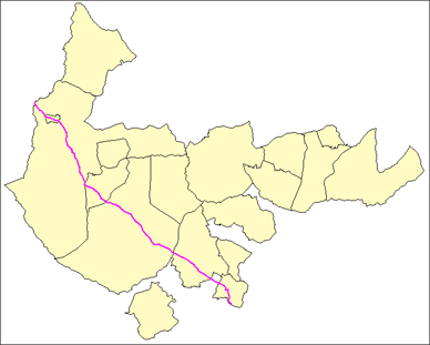
The beginning of this big route in the region is already a unique place. The landscapes of the Barruecos are one of the Natural Monuments of Estrémadure labelled where we will find good examples of flora and fauna; and what´s more, the place has welcomed an interesting quota of population of distant epochs from where the material remainders have arrived (lived places, Roman cities, dólmenes and an industry of stones) currently being studied. But the more important place of the Barruecos, besides its impressive granite candlepins, is the washer of wools of the XVIIIe century. This restored structure has accommodates an eccentric tandem: the Centre of Interpretation of the drovers´ roads and the collections of contemporary art of artists like Vostell. We will always follow the drovers´ roads, with different names according to the municipal term that they cross. We will go above the Roman way that linked Cordoba with Oporto, the roadway of the Roman Bridge of Alcantara, as ignored nowadays as important was at its epoch; as an example there exist the impressive Bridge of Alcantara, or the most modest one of Segura (Alcantara), among other traces of the epoch.
We will cross the town of Arroyo de la Luz with an interesting heritage. After that, we will go towards Brozas, but firstly we will enjoy the different landscapes like the pastures or the fields of Araya. After crossing Brozas, and following the road that deserves a visit, we will enter into Villa del Rey fields, to reach Alcantara. We will abandon the town of the old Order of Alcantara after crossing the Roman Bridge. This a mute witness of the time running, close to the modern work of the Pool of Alcantara. If we follow the Real Valley of Gata, the Roman way, and the current road, we will reach Piedras Albas, which is the small border town that preserves the customs building. After that, we will go towards Erjas, crossing the international Roman Bridge of Segura, which is a small imitation -in miniature- of the Bridge of Alcantara, where we will find the limits between Spain and Portugal. In this point the Road of the Wool hispano-extremeña finishes and starts the Route da Lã portuguesa. This route will take us to the manufacture centre of wools in Covilhá.
|


 Download the Table